Showing posts with label tramping. Show all posts

Sunday, 16 August 2009

15th -16th August 2009: Waitawheta Hut

Saturday in Auckland dawned grey and rainy, and there was a severe weather warning for heavy rain in the Kaimai Ranges. This wasn't quite what we had hoped for, since I had planned a two-day walk there to the Waitawheta Hut with Ken and Mark. Despite it plainly being a day best spent in a warm pub, we set off anyway. We did make one concession: instead of taking the flattish route with 6 substantial river crossings, we opted for the high route in over the top from Te Aroha.

We started the walk at about noon with a 2-hour ascent up the Te Aroha mountain which, at 952m, would count as a Munro were it Scotland. With the car at 15m this was a sizeable start to the day, and it was impressively steep and muddy.

From the top, we then had 4 hours of tramping on some outrageously muddy tracks, undulating over valleys and crossing swollen streams. It was so wet, even the possums were giving up - we found one dying on the track (presumably poisoned). We had not really done our sums on the timings or we would have realised a bit sooner that we were going to get to the hut after dark. Once we did cotton on we sped up quite a bit, and by the time we'd had three stream crossings come up to our knees we were definitely getting the hang of them: there was no time for niceties like taking your boots off, we just had to wade through. We were just discussing (by torchlight) the remaining half-hour of walking we thought we had left when the hut appeared around a corner. I have rarely been quite so relieved to see a shelter.

Ken, about to cross one of the smaller streams

We shared the large and comfortable Waitawheta Hut with a group of 13 from an Auckland tramping club. Given the weather we hadn't expected to see anyone else there, and neither had they. It wasn't as sociable as some of my previous hut visits: there was some banter but as is often the way, everyone was in their sleeping bags by 9pm. Outside, it rained, all night.

The following morning we had to retrace our steps. The rain had eased, but the mud had just gathered strength. It took us about 5 hours of battling though the stuff to get back to the Te Aroha mountain. Every step was in water or mud. We couldn't face the ascent to the top again, so we circumnavigated for a further 2 hours before finally reaching the car, totally exhausted.


Ken and Mark, on our way back on day-2

It was one of the tougher walks I've done, and certainly the muddiest. All three of us had our moments of feeling dreadful, but when you're in the middle of nowhere you've got no choice but to keep on going. It's all part of the adventure - nobody is going to come and carry you out! I also took a nice knock to the head when I walked straight into a big over-hanging branch - it's left a decent mark.

More photos here.

Sunday, 26 July 2009

25th July 2009: Waitakere Ranges Walking

Things have quietened down a bit since Sophie left - we had been trying to squeeze as much as we could into her last weekends here, and I haven't had much planned since. I did manage another sail at Panmure Lagoon Sailing Club last weekend, but it wasn't much to write about.

With Ken now back on the CHP NZ team, things were bound to get busy again. This Saturday I was supposed to be having another kite-surfing lesson, but the day dawned calm so that was abandoned. Instead, Ken and I headed to Cascade Kauri in the Waitakere Ranges for bit of a walk.

Sophie and I have been here before - there are some excellent stands of mature Kauri in the area and I wanted to see some more of them. From the car park, we took the Lower Kauri Track ("for experienced trampers only"!) which had some entertainingly muddy and steep sections. We then went north to take the Whatitiri track back to the car park, which crosses some grassy fields offering, unusually for the Waitaks, a open view.

Somewhere around then we lost the track. This doesn't happen often in NZ - they're normally very clearly marked. I suspect it was when Ken went to 'play' with a flock of pukekos. We'd been wandering around for a while, and were just discussing how to make a tent out of fern leaves, and wondering what pukoko would be like for dinner, when we found the track again and our fun was spoilt.

We saw quite a few birds in that area: pukekos, fantails, red-crested parakeets, a wood pigeon, an NZ robin and plenty of tui. Not a bad haul. It's interesting how this year in NZ has turned me into a little bit of a twitcher. Only a bit though!

Monday, 20 July 2009

11th-14th July 2009: Sydney

On my way home from NZ, I stopped off in Sydney for three days. I had a new relative to meet, a few friends to see, and wanted to fit in a little sightseeing.

It turned out to be a sociable stay. Kate, a colleague of Tim's, very kindly picked me up from the airport to drive me to my hotel and waited while I got settled in. Perhaps too kindly; Sinclairs at Bondi has a quirky feel and a very friendly and helpful host. By the time he had finished showing me round and giving me maps and useful information, I fear Kate's brother may have demolished the lasagne she had left in the oven.

Bondi Beach

In the course of the next couple of days I was plied with gin and tonic, cooked dinners, and generally welcomed by Kate, her brother Jon (who cooked me a delicious roast even though I'd never met him before), and ex-colleagues Rich and Nick. I also had the pleasure of meeting my three-month-old second cousin Lorelei, who frankly cannot be real. When I arrived she was asleep; she soon woke up and spent some time grinning at me; she then had a meal and went down for another nap. Is this really what babies are like?

In between times I fitted in a few touristy things, starting with a visit to the Art Gallery of New South Wales to see the Aboriginal art. I just love those bold colours and spotty crocodiles, although I am woefully uninformed about the meaning underlying the pictures.

I also walked the Manly Scenic Walkway, which wasn't honestly all that manly, being a well-graded 10km walk that any girl could manage. It was certainly scenic though, taking in surf, beaches and the native bush of the Sydney Harbour National Park.

Tourism-wise, the highlight of my trip was whale watching. This was something I had never quite got round to doing in Auckland. I'd love to say it was because I knew it would be better in Sydney. I discovered that Sydney is situated next to a highway for humpback whales, which every year swim north to the tropics to breed, right past the mouth of the harbour. My boat - a triple-decker ferry-like affair, but fast and with plenty of viewing space - located a passing humpback in minutes. We spent at least an hour watching two of these amazing creatures rolling along, surfacing to breathe, and diving with that classic tail-flick.

Humpback whale

Wednesday, 8 July 2009

3rd-7th July 2009: Lake Waikaremoana Great Walk

I am flying out of New Zealand for good on Saturday. I've had the most awesome year and will miss this place, but there are too many things at home to pull me back - family, friends, and a better selection of job opportunities even in recession. I'm fairly sure, however, that once I set foot back in London I'll wonder what ever possessed me to leave NZ.

Tim is staying on until early September to finish up his project work. Meanwhile, making the most of our time left together, we did the Lake Waikaremoana Great Walk over the weekend. I've now walked 4 out of the 9 Great Walks in New Zealand, which feels like a respectable total for the year.

The walk is a 46km track south of Rotorua. It took quite a while to get there. After the 3-hour drive from Auckland to Rotorua we had another 150km to go, 80 of which were on a winding unsealed road through the national park and took easily a couple of hours. Total journey time was 6-7 hours each way, which is why we exhausted the walking options nearer to Auckland before tackling this one.

We walked the track in the standard 4 days, in company with an Irish backpacker named Owen. We met him when we shared track transport at the start of the walk, and happened to have chosen the same huts to stay in. He was doing some travelling after finishing his degree at Trinity College Dublin and before training to be a teacher.

This walk was as beautiful as usual, the track easy apart from a fun side trip to the Korokoro falls. We crossed a river by scrambling over rocks with a wire to hold on to, then walking a fallen log. It had rained the night before and the swollen river made the crossing a bit more challenging than it might have been.


What was really notable about this walk was the difference from other Great Walks owing to the time of year. Cold huts (really, two-sets-of-thermals-and-a-sleeping-bag-and-still-shivering cold), much less crowded of course, and sunset shortly after 5pm. These huts did not have solar lighting so we spent the evenings chatting or playing cards by candlelight.

Two of our three huts had feeble gas heaters which, as the DOC had warned us, barely took the chill off the air. The middle night, in Waiopaoa hut, was sheer luxury with a wood-burning stove. We only had a 3-hour walk to this hut, reaching it by lunch time, after which we spent a pleasant afternoon gathering and chopping firewood, and an equally pleasant evening watching the cosy blaze we had made. I should probably regret that my childhood was not spent doing more things like that.

Huddled round the gas heater at breakfast time.
Owen is standing up in the grey jumper.

Thursday, 2 July 2009

27th-28th June 2009: Waipoua Forest

The mighty Kauri trees of northern New Zealand have featured quite prominently during our year in NZ. We first encountered them on the Pinnacles walk back in August last year, and I've been fascinated by the history surrounding these giants ever since. Their timber and gum had a huge impact on the development of NZ once Europeans arrived and started exploiting them.

To sate my curiosity, we used one of our two remaining weekends together on a Kauri extravaganza: a trip to Waipoua forest, which is the largest remaining area of mature Kauri forest, and a stop on the way at the Kauri Museum in Matakohe.

The museum has an excellent collection of all things Kauri-related apart, oddly, from a general introduction to the trees. We were glad to have known some background before we arrived. There are sections dedicated to the history of the sawmills, gum-digging and the so-called swamp Kauri: trees tens of thousands of years old that fell into bogs and were preserved. I think Sophie enjoyed the period-lifestyle displays more than I did, but there we plenty of big machines to keep me interested.

Perhaps the most interesting display was a lengthwise section of a mature tree that was recently killed by lightning. On its side, it gives a good impression of just how much timber there is in these trees and why they were so sought after. On the wall beside it there's a cross-section of the tree measuring 2m in diameter. Painted outside that are outlines of rounds of larger Kauris - some of which beggar belief in their scale.

The cross-section and outlines are on the wall behind - use the chair for scale!

After the museum we headed north to the Top 10 Holiday Park in Kaihu. Top 10s usually come across as characterless and densely-packed caravan parks, but in the uncrowded low season we were pleased with our cosy little lodge: a comfortable double bed and a bijou kitchen in a beautiful spot by the river, all for 75NZD. We had planned to go on the organised kiwi-spotting tour but rain and a nascent cold put me off.

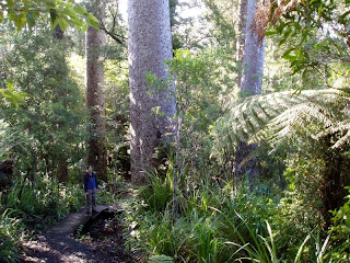
On Sunday we headed up to Waipoua Forest itself. Some driving and walking took us to a number of massive trees: Tane Mahuta, the largest living Kauri by volume, and Te Matua Ngahere, the largest by girth. We also walked to Yakas, which is smaller (though still huge) but isn't surrounded by protected fences so you can get close to it.

Sophie in front of Yakas - the 7th largest Kauri tree

One thing is for sure: you can only really appreciate these trees by seeing them yourself!

Thursday, 11 June 2009

6th-7th June 2009: Coromandel Peninsula

Coromandel is another trip that has been on our to-do list since we got here, but we saved it until winter, knowing that the weather would still be passable up here when it got cold further south. We were rewarded with a balmy weekend and a brilliantly blue Pacific.

Tim's colleagues James and Ken came along for the weekend and we drove around the standard tourist haunts. Hot Water Beach was similar to the one we previously visited at Kawhia, but with even warmer water - plenty of people were wallowing in their bikinis despite the fact that it is really not quite summer any more, even here.

Cathedral Cove was beautiful, with weather-sculpted rocks towering over the water. Some local walkers pointed out an eagle ray in the shallows and we watched it for some time. It was hard to get a good sight with the sun reflecting off the water, so Ken waded in to get nearer, much to the detriment of his jeans. He wore them for the rest of the weekend anyway.

Anything for a good photo

In Coromandel Town we enjoyed a surprisingly good meal at the Peppertree Restaurant, one of only two restaurants in the one-street town. Coromandel is a centre for farming green-lipped mussels and these ones were particularly succulent. We stayed away from the local wine though, assuming there was a good reason we hadn't seen it on menus outside the peninsula. Maybe it was great and we missed out.

The next day we took a tour bus to the tip of the peninsula to walk the Coromandel Coastal Walkway. Our driver was a very well-meaning lady who told us everything she knew about the local history, and persisted in referring to our three-hour amble as a great achievement, even giving us certificates for completing it. She advertises it as a 7km walk, but told us after the walk that it was 10km, but she doesn't tell people in advance because they wouldn't do it. The DOC website lists it as 8km. Sigh.

Tim colour-matches with the Pacific

After the twisty, unsealed road back to Coromandel Town in the bus, we got back into our rental car (a cheap-as Nissan Sunny of 1990s vintage) for another 3-hour drive home. Our mood was lifted half an hour later though, when Tim spotted a pod of dolphins in a bay by the coastal road. We stopped to watch and saw lots of fins and a few leaps. These appeared to be bigger than the dolphins we saw in the Bay of Islands, and there were plenty of them, maybe 15-20. The road home seemed much shorter after that.

More photos here.

Monday, 8 June 2009

1st June 2009: Montana Heritage Trail

It was the Queen's birthday bank holiday in NZ, so in amongst some wedding planning we did another trip out to the Waitakere ranges, 45 mins west of Auckland. This time, we headed to the northern end of the park to walk the Montana Heritage Trail, a track through the bush sponsored by Montana Wines who used to be based nearby.

We extended the walk a little to take in the Waitakere tramline. This line was orginally built for the construction of the nearby dam, but now occasionally takes passengers. It wasn't running when we were there but you can just walk along the track instead. It has an unusual railway station at Picnic Flats, a somewhat incongrous area of neatly trimmed grass in the middle of the rainforest.

A novel aqueduct, taking a stream over the tramway

On the way back, we passed along the Upper Kauri track, which has some of the best stands of mature kauri trees we've seen. It some parts you are surrounded by trunks over a metre thick, rising up like towers above you. One of the trees was wider than my arms streched out, around 2 metres across (photo). Much of this part of NZ would have been like this - before it was all logged early last century.

Sophie gives some scale to the kauris

More photos of big trees here.

Monday, 1 June 2009

23rd-24th May 2009: Tiritiri Matangi

The bird sanctuary island of Tiritiri Matangi has been on our to-do list for months. Situated in the Hauraki Gulf, it is free of mammal pests such as rats and possums and home to many endangered bird species. Mammals introduced to New Zealand have wreaked havoc with the native birds, especially ground-nesters whose eggs are easy prey, so this is a big deal conservation-wise. Tiritiri Matangi is also the island that until recently said Ni (say the name in a high-pitched voice and you'll see what I mean).

We spent two days on the island, spending the night in the bunkhouse so that we could go out after dark looking for kiwis, which are nocturnal. But a couple of hours of peering into the dark bushes didn't yield any sightings of the elusive birds, although we heard plenty calling. It was quite windy so they may have been staying well-sheltered, or perhaps we just couldn't hear them moving over the rustling of the trees.

A bellbird

During the day we did better. Walking around we were followed several times by fantails, feeding on the flies our feet dislodged. We also saw dozens of honey-eating bellbirds and stitchbirds at feeding stations maintained by the park rangers, as well as saddlebacks, whiteheads, kingfishers, New Zealand robins, parakeets, and the more common tuis and pukekos. The best were the takahe. These football-sized flightless birds are extremely rare, but there are three living near the visitors' centre on the island who are almost overly friendly and all too keen to steal your lunch if you look away. Quite a surreal experience - somehow I expect rare creatures to be shy. Maybe this gives some insight into why they're nearly extinct.

Tim bonds with a takahe

Staying in the bunkhouse was, as ever, a fascinating experience. With us were a couple of other people on holiday and five or so volunteers and researchers who work on the island. Some had led very varied and interesting lives and told dinner-table stories that were well worth hearing. One man had been an airport customs officer, and told us about a woman who tried to take her dead father on a plane as a passenger in a wheelchair. (Do you have any idea how difficult it is to ship a body in a coffin?) Luckily he noticed before she boarded...

Tim got a lot of good pictures - see here. Of course we also threw away lots of pictures of empty branches a bird had just left :)

Monday, 4 May 2009

2nd-3rd May 2009: Mount Pirongia

The tramping tracks in Pirongia Forest Park are some of the most challenging we have walked. Our two-day tramp up Mount Pirongia and back took in two long ridges, each with a series of small steep-sided tops, and there were a fair few scrambles. Scrabbling up and down rocks is made harder if you have a 10-15kg pack on your back!

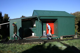
We walked up the mountain from Grey Road via Ruapane and Tirohanga Tracks, returning on Mahaukura Track, and spent the night at Pahautea Hut, a compact 6-bunk building near the 959m summit of Mount Pirongia. The last to arrive, barely before sunset, we were lucky to find exactly two beds left.

Pahautea Hut

The other beds were taken up by a very talkative homeless bird photographer who was spending a week in the hut; a couple of hunters, complete with orange camo shirts (deer can't see orange, but other hunters can); and a keen young traffic light engineer who is determinedly taking up tramping after going on an Outward Bound course earlier this year.

One of the great things about staying in the huts is that we meet people we never normally would. Sharing a single room with no heating or lighting (we were lucky someone had left a couple of candles), we chatted for a couple of hours after dark before fleeing to our sleeping bags for warmth at 9pm. All our companions were tradespeople who do manual, outdoor work, and inhabit a world I have little exposure to. It brought home to me how narrow my experience is. But then again, they have as little idea about my life as I do about theirs.

The other contrast we encountered was one we have often seen: the variety of walkers we meet. In the hut we were probably the least experienced in the group. Four punishing hours from the summit and one hour from the car park, the track got wide and easy and suddenly was busy with young families and older couples, looking faintly awed at our muddied legs and big backpacks.

Friday, 1 May 2009

24th - 26th April 2009: Rotorua & Kaimai Ranges

Our next set of visitors, Mel and Dom, arrived in town on Wednesday. We spent the weekend with them in Rotorua.

Saturday dawned drizzly, so we went for an epic breakfast at Relish Cafe and stuffed ourselves on their excellent "Bennies". After this, we had an urge to roll down a hill in an inflatable ball, so we headed to Zorb Rotorua. Mel and Dom had a two-person ride while I took the solo zigzag track.

Now cold and wet, we climbed into the car and put the heating on full blast for the short drive to Agroventures. Not nauseated enough by the Zorb, Dom, Mel and I did a Swoop together: a ride where you are winched 40m into the air and then released to swing at 130kph, trussed up in a harness that makes you look like a giant caterpillar.

To conclude our extreme sports for the day, Dom and I raced on the Shweeb. This is a monorail track with a suspended recumbent cycle. Obviously I beat Dom, but only by half a second.
From there we raced to the Sheep Show, which surprisingly was just as good on a second viewing, and then headed to Waikite Valley for a welcome hot soak. Dom and Mel spent the evening at a hangi, while Sophie and I had a delicious dinner at Bistro 1284.

The next morning Dom and Mel headed for Taupo, and Sophie and I went for a rather wet walk in the Kaimai Ranges. Starting on the Waitawheta Tramway, we were hoping to follow the Bluff Stream Kauri Loop Track, but found we would need to make a few knee-deep crossings of fast rivers. Instead we took a loop via Daly's Clearing Hut. My boots leak so I got wet feet anyway...

Monday, 20 April 2009

14th-15th April 2009: Taupo, Orakei Korako and Rotorua

With the wine tasting now over, we finished up our Easter trip up by visiting Taupo and Rotorua with my mum and Ian.

We managed to squeeze in a late visit to Orakei Korako, reputed to be one of NZ's best thermal areas, and it's certainly the best we've seen. Huge silica terraces with boiling water flowing out, a big cave with a hot pool at the bottom and excellent bubbling mud. I've since been told White Island is very impressive too, so that's now on the list.

Our last evening's dinner was memorable. We went to Bistro Lago in the Taupo Debretts resort. This is another Simon Gault restaurant, just like Jervois Steak House in Auckland. He has a certain truffle-loving style that I do seem to get on well with.

The following morning, after eyeing up distant Tongariro and Ruapehu from our B&B, we took in Huka Falls and Aratiatia Rapids and headed to Rotorua. We dropped Mum and Ian at Te Puia for their dose of Maori culture and geysers, while Sophie and I went looking for a walk. We found the very pretty Redwoods forest, just outside Rotorua. Redwoods somehow feel a little out of place in NZ: they're quite unlike any of the native trees, but impressive nonetheless.

To finish our trip we went up the Skyline gondola for a view and a spot of luge. The luge is much more fun than it deserves to be - an experience a bit like skiing but sitting down. Mum took to it particularly well, getting her luge up on two wheels on occasions...

Saturday, 18 April 2009

10th-12th April 2009: Martinborough

Having scooped my prospective parents-in-law off the ferry, we set off to conquer the wine regions of the North Island. We started at Martinborough, north-east of Wellington, and stayed in the charming and comfortable Martinborough Hotel.

Martinborough is unusual in that most of the wineries are small and close together. This makes cycling an ideal way to get around them, allowing for a long day of tasting and a wobble home afterwards. Luckily for our livers (and the drivers of Martinborough) we were only able to get bikes for the morning.

Ian, making good use of the bike's drink holder

We visited Martinborough Vineyard, Winslow Wines, Ata Rangi, and Benfield & Delamere. Winslow was the most memorable, both for its excellent wines and the interesting but long-winded discourse from the owner on matching wines to food; it took an hour and a half to taste four wines. Ata Rangi is the source of the delicious Pinot Noir given to Tim by Nishan, but we weren't allowed to taste it that day.

We finished up with a late lunch at the Alana winery. Winery restaurants always seem to have good food and great settings. By the end of lunch we were fit for nothing more than a snooze before dinner.

The next day we set out for Hawkes Bay, but stopped on the way for a short walk in Holdsworth. We battled up a steep track to a viewpoint with great views of Mount Holdsworth and the surrounding hills. By all accounts the walking at the south end of the North Island is great - shame it's such a long drive from Auckland.

Monday, 30 March 2009

21st-22nd March 2009: Around Raglan

After Jenny and Eric left Raglan to catch their flight home, Tim and I stayed for an extra night to make the most of the weekend. We stayed in the Harbour View Hotel, an old-fashioned building built in 1905, with high-ceilinged bedrooms and a shared bathroom down the corridor. I imagined ladies in long skirts treading those same floors long ago.

The next morning we climbed Mount Karioi, the only significant peak in the area. It was a sunny, clear day - summer just doesn't want to end round here - and we had beautiful views over the Tasman Sea, Raglan Harbour and the surrounding countryside. We didn't see a single person all morning.

On the side of Mount Karioi

Back down by lunch time, we made our way to Kawhia, via a quick stop at Bridal Veil Falls. The road to Kawhia is 40-odd km of gravelled road, and at the end of it is a hot-water beach. An hour or two each side of low tide you can dig a hole in the sand and see it fill with hot water from underground springs. It is slightly strange to watch a few dozen people sitting in holes dotted along the beach, but great fun. Lacking a spade, we availed ourselves of existing holes that had been abandoned and enjoyed a soak.

Photos of the whole Raglan trip are here.

Wednesday, 18 March 2009

15th March 2009: Tamaki River Walk

Way back last July, Tim and I did New Zealand's notably short Coast to Coast walk. The leaflet describing the route had two other walks to offer, and we gave one a go on Sunday: the Point to Point walkway along the Tamaki River estuary.

The Tamaki River goes almost all the way through to the other side of the North Island; it's only around 2km between the river and the west-coast Manukau Harbour. The Maori used the isthmus as a portage point for their canoes.

The walk was good, hugging the beach on the wide sandy estuary as much as possible. At one point you walk out onto the Tohuna Torea Nature Reserve sand spit and at low tide you can walk back to land on an expanse of sand that is usually under water. It was fairly low tide when we did this and we escaped with only mild dampening of the feet. We later worked out that it was neaps, which possibly explains why we didn't stay drier.

Saturday, 28 February 2009

22nd February 2009: Rangitoto Island and Cornwall Park

Rich vdH and Hilary came to stay for a couple of days at the end of their holiday in NZ, and we took them to Rangitoto Island. It really is a pretty unique place - I get the feeling we will make another few trips there with visitors before we go home.

We gave ourselves three hours on the island, then inevitably packed enough in that we had to get a move on to see it all. This was made more amusing by the fact that Hilary's walking boots had died a few days earlier. When we arrived at the island the soles were not fully attached; by the time we left, one had fallen off entirely and was tied on with the ends of her shoelaces. The boots just about made it back to our flat before being consigned to the dustbin.

After that exertion we went to Cornwall Park for tea in the cafe on the side of One Tree Hill. This is the cafe we found on the coast-to-coast walk, that had its own tea sommelier. Having already eaten a sizeable lunch, we found space for a cream tea all round before a little kite-flying in the park.

Tuesday, 17 February 2009

9th-11th February 2009: Taupo

On my way home from the Tongariro Northern Circuit, I spent a couple of days in Taupo. Lake Taupo is bigger than Singapore. It is beautiful, but its size is disappointing in a way; I could hardly see the land on the other side so it was more like being by the sea.

The first day I walked to Huka Falls. They are part of the Waikato river, the only river to flow out of Lake Taupo and the longest river in New Zealand. Near the lake it's immensely clear and blue; at the falls it is channelled into a narrow gap making the most impressive rapids I've ever seen, then rages over a 10m drop. The photo doesn't really do it justice - you'll have to visit it yourself.

Huka Falls

The next day I went for a sail on the lake aboard Barbary, to see some Maori rock carvings. Seemingly I'm destined to find classic yachts wherever I go; this one was built in 1926 and belonged to Errol Flynn, reputedly after he won it in a game of cards.

Barbary

More photos here.

6th-9th February 2009: Tongariro Northern Circuit

Following on from the Tongariro Alpine Crossing walk with Tim and CHPers, I stayed on the track for another two days to complete the Northern Circuit. While they walked out to the carpark, I stopped at Ketetahi Hut for the night. This was a fairly interesting place to be for a couple of hours; around 2000 people walked the crossing that day and their exit route goes across the deck at the front of the hut. The few of us staying for the night sheltered inside from sunshine and the hordes of trampers, until the rush quieted down and we could enjoy the usual peace of the backcountry.

This was my first experience of walking alone, and I expected to be somewhat bored in the evenings. I'd packed as light as possible, having no-one to help spread the load, so the big fat novel hadn't made it into my pack. However, the wardens in both Ketetahi hut and Waihohonu hut, where I spent the next night, were much more sociable than the ones we had met on the Fiordland great walks; perhaps because the Tongariro is a much less popular walk, with often only 5-10 trampers in a hut, so it's easier to get chatting in a group.

Walking at dawn

The walking was easy too, largely over flattish scrubland, and I had a great time. One part of the track has black sand and small scrubby plants, and looks for all the world as if it's 50 yards from the shore at Piha or Karekare.

My favourite people of the tramp were a lovely French couple, Jean and Françoise, who have lived in Australia for almost 40 years. They told me enough about their grown-up grandchildren, and daughter's 40th birthday, to make me most impressed that they are still hiking with big packs on their backs. They obviously make a habit of this and have done tougher and longer walks than this one. If I'm half as fit at their age I'll be well pleased.

Françoise and Jean

More photos here.

Monday, 16 February 2009

6th-7th February 2009: Tongariro Alpine Crossing

One of the things remaining on our must-do list was the Tongariro Alpine Crossing, allegedly New Zealand's best one-day walk. We walked to a DOC hut near the start point the night before to get an early start and give ourselves the time to climb one of the volcanos that the main track skirts. This also gave Sophie, newly time-rich, the opportunity to do the full Tongariro Northern Circuit, of which the crossing is day 2. We took a bunch of CHPers along: Alex, James, Luke and Ken.

Day 1 was a late start after the drive down but a short 3-hour yomp took us to the Mangatepopo Hut near the start of the crossing. We had an chilled-out evening drinking some wine, playing cards and watching the sunset.

On day 2 we left the hut at 6:50am with the tops shrouded in cloud. We reached the first saddle an hour or so later, and decided to begin the climb up Ngauruhoe (pronouced Nah-eu-ru-ho-eh or something), a nearly perfect volcanic cone towering above the area. This turned out to be somewhat more challenging than we expected, with about 700m of loose scree and sharp volcanic rocks. The views from the top made it worth it though, as by the time we got there the clouds had cleared completely.

The view from the crater of Naguaruhoe

The remainder of the crossing provided us with views of bright-red craters, emerald lakes and steaming thermal areas; a spectacular collection that really has to be seen in person to be appreciated. Our legs had appreciated enough by the last hour or so of the walk - the volcanic side-trip adds quite a bit to an already substantial outing.

CHPers and a volcano

Having now 'done' Ngaruramaramawhakahoe, next time we'll only have to do the cushy amble to the summit of Tongariro.

More photos here.

Monday, 2 February 2009

31st January - 1st February 2009: Kauaeranga Kauri Trail

We repeated the walk to the Pinnacles Hut, this time taking more people, more wine and more steak. With us were Mark, Nishan, Kate, Stephen and Luke.

Saturday was hot and humid, but the climb up to the hut felt a lot easier than the last time we did it. We arrived at the hut in plenty of time to climb the Pinnacles that afternoon and enjoyed a display of rock-climbing skills by Luke. Later we paddled and admired the reflections in the amazingly calm pools near the hut.

Not far from the Pinnacles Hut

The evening was great fun: there's something very satisfying about having carried wine and steak up a hill, that makes you enjoy it all the more. We timed Stephen (a fell runner by trade) climbing back up to the Pinnacles summit in 8 minutes to get mobile reception to call his girlfriend.

On Sunday we split into two groups. The majority opted for the longer walk back via Moss Creek campsite, while Tim, Sophie and Nishan took the Billygoat track. We had a very relaxed lunch sitting just above the Billygoat Falls (Sophie thinks this may be the best lunch spot ever), while the others bush-whacked their way out. Stephen set off alone on a detour and got properly lost for a while. It's hard to appreciate just how wild this area is as soon as you're off the track: you're many miles from help, and one bit of bush looks exactly like another. Luckily, after some swimming down a stream, he found his way back onto a track and out.

The final swing-bridge over the Kauaeranga river

More photos here.

We'll be sorry if we don't get to visit this area again, but there's so much more to see!

Sunday, 18 January 2009

2nd-5th January 2009: Kepler Track

"Hello. We'd like to pick up our hut passes for the Kepler Track, please."

The man in the DOC office in Te Anau was very helpful. "Here's the forecast for tomorrow. I think they'll probably close the alpine section of the track, because the wind is forecast to reach 100km per hour above 1000m." Well, we wouldn't get to the high level section until the following day, but what would happen to all the people who weren't able to do it tomorrow? Would the hut tomorrow night be somewhat overcrowded?

"The next day the wind looks like dropping off a bit [a mere 70kph] but it's going to snow above 1200m. Also there are some trees down on the track you'll walk tomorrow. I believe it's passable though. Oh, and watch out for the falcon in the Rainbow Reach area. It's been attacking walkers on the track, so be sure to wear a hat. We had a chap in here two days ago with a great gash across his head."

Hmm. This wasn't how the Routeburn Track had started out a few days before. That was much more a case of, "Here are your tickets. Would you like a rubbish bag?"

Still, Anna, Chris, Tim and I defied fallen trees, weather and aggressive falcons, and set out the next morning on our four-day walk. Seemingly against all odds, we managed to survive it unscathed and without track closure.

Day 1 was an 800m climb in the rain. We didn't hang aboout; even brand new Gore-Tex doesn't keep you dry in Fiordland rain, so breaks were kept short to avoid getting cold. We reached Luxmore Hut by about 2pm and spent the afternoon and evening drying off our kit together with 50-odd other damp hikers. That evening we had some lovely views across Lake Te Anau - the clearest views of the walk, as it turned out.

Luxmore Hut

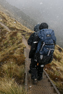
Day 2 is the alpine crossing, and was a day of intermittent horizontal snow. Somehow this felt more Christmassy than anything yet - snow on 3rd January makes me feel as if I'm at the right end of the world. Slightly weird to have it a week after midsummer in NZ though.


All we could see from the highest point (the 1472m Mount Luxmore) was the inside of a cloud. However, we had more luck at the last viewpoint just before dropping back below the treeline, and enjoyed some pretty partially-clouded views over Lake Manapouri. They fuelled us for the 91 hairpin bends in the track through the trees to Iris Burn Hut.

Chris and Anna walked out from Iris Burn to Rainbow Reach the next day, while Tim and I stayed in Moturau hut and walked out to Te Anau the day after. The final evening was great fun; three days of walking and some bad weather had made the hut atmosphere very sociable, and we were pleased to find we were chatting with the owners of Artisan Wines, a winery just outside Auckland. We feel it would be only polite to visit and sample their wines some time soon. Earlier in the walk we had also met a very interesting DOC employee whose uncle originated guided walking on the Routeburn Track.

The Kepler had its moments for weather, but turned out to be a great walk for wildlife. We saw a number of keas showing off the bright orange underside to their wings; fantails in the woods near Lake Moturau; a sleek stag in velvet near Iris Burn Hut; a falcon (which didn't attack us, and which we would have thought was part of a treestump had the DOC man not pointed it out); and Chris found glow-worms under a rock near Iris Burn Hut.